Summary of Discoverers of America
Columbus was certainly not the first person to explore the Americas. There is a lot of evidence that many other people visited the land we call the Americas, long before Columbus.
As we discuss these early visitors, think about “how” they discovered the Americas. What route did they take? Were they expecting to discover the Americas? Did they end up there by accident? Did they all explore the same America? What was their purpose? What was the impact of their discovery? How long did they stay?
Refer to the students’ answers to the question “Who discovered America?” at the beginning of the program. For example: “You mentioned the Native Americans, and Leif Ericsson.”Let’s look at Columbus.
VISUAL 25 (still): World Map with Columbus’ Route to the Americas
DIGITAL EFFECT: Forward Diurnal Motion
Run diurnal motion forward indefinitely. This is done simply for effect.
Please turn your paper over, and draw Columbus’ route from Spain to the Americas.
He heralded a great influx of European explorers that had a most extreme effect on the Americas. Yet Columbus never found the mainland of the Americas. He thought he had reached the Indies.
VISUAL 26 (still): Vikings
[Fade on the still image of Vikings.]
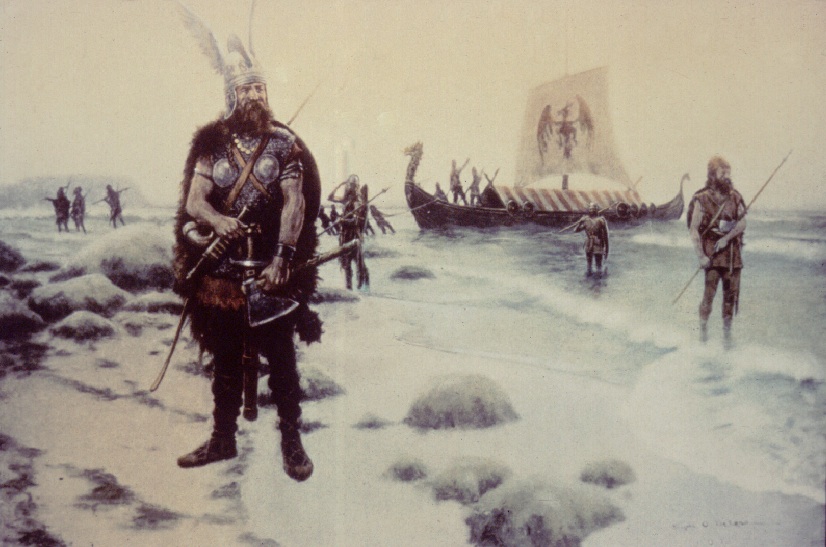
Vikings from different countries have told the same story about visits to North America. Two very old Icelandic-Norse sagas describe, in clear, believable detail, the exploration and settlement of North America about 1,000 years ago.
According to the sagas, the first Viking to sight North America was Bjärni Herjolfsson, who was sailing from Iceland to Greenland during the summer of A.D. 986. Searching for new sources of timber, he was blown off his original course, and ended up in North America. Later, Leif Ericsson heard about this accident. He bought Herjolfsson’s 76-foot ship and assembled a crew of 35. They set out from Greenland to find the land Herjolfsson described, but did not explore.
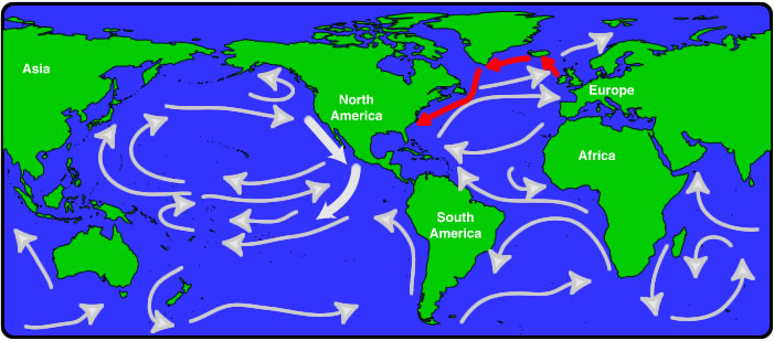
VISUAL 27 (still): North and South America with Sites Marked
[Fade on the still image of the World Map with Leif Ericsson’s Route Marked.]
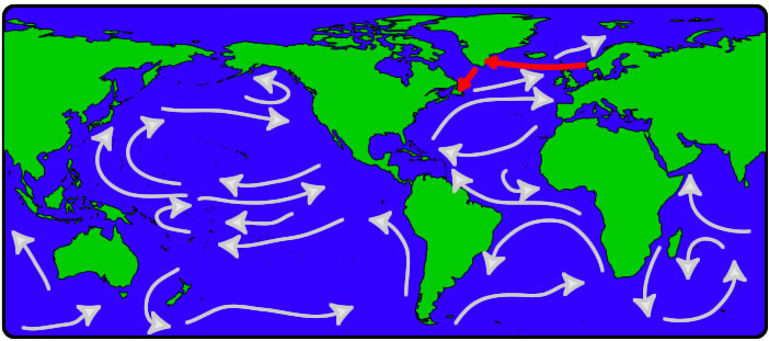
DIGITAL EFFECT: Ericsson’s Route
Scale down and fade off the Viking image.
Sailing from Greenland, Ericsson explored the northern islands and coast of the Americas as far south as what we call Newfoundland. He built a camp for the winter. This campsite was probably the first European settlement in the Americas. Different Vikings lived there, off and on, for about 20 years. They were expelled by angry local Native Americans, whom Vikings had mistreated. (Vikings had somewhat of an image problem in other places, as well.)
In recent times, evidence of the Viking settlement has been found on the northeastern tip of Newfoundland.
Use your pencils to draw the route taken by Leif Ericsson to the Americas.
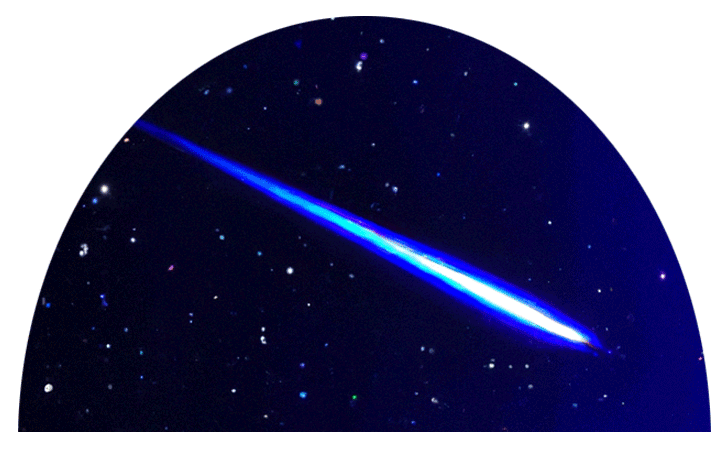
VISUAL 28 (still): St. Brendan in a Boat
Sometimes, we find hints of early voyages in other stories. An ancient Irish saga, the “Voyage of Saint Brendan, the Abbot,” describes a journey, by ship, made to a place called “The Land Promised to the Saints.” It was somewhere beyond the far reaches of the Western Atlantic.
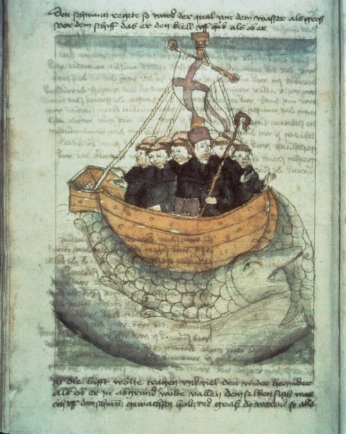
According to this legend, St. Brendan and 17 fellow monks set sail from Ireland in a leather-hulled ship about 1,400 years ago. The entire voyage lasted seven years. The monks experienced things never before encountered, such as a floating crystal column.
What could the floating crystal column be?
[It was probably an iceberg.]
St. Brendan also saw a sea creature as great as an island.
What type of creature was that?
[Most likely, it was a whale.]
Finally, St. Brendan and his shipmates reached a huge, lush island divided by a mighty river. They managed to sail back home to Ireland, where St. Brendan later died.
Let’s look at the map. What route could St. Brendan have taken?
[Discuss and then show the image of St. Brendan’s route.]
VISUAL 29 (still): World Map with St. Brendan’s Route Marked
DIGITAL EFFECT: St. Brendan’s Route
Scale down and fade off the St. Brendan in a boat image.
We really do not know the route St. Brendan sailed. It may have been like the one we see here.
Let’s draw on our maps the route St. Brendan might have sailed.
Very little evidence exists today to confirm that St. Brendan and company actually visited North America.
Remember the Chinese priest, Hwui Shan? He came to the west coast of the Americas over 1,500 years ago.
What was his route to the Americas?
VISUAL 30 (still): World Map with Asian Route Marked
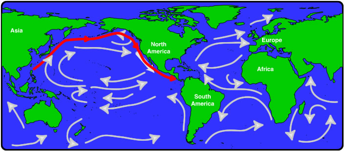
Let’s draw the route from Asia to the Americas on the map.
[Students draw on their maps.]
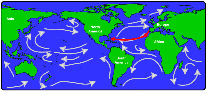
For safety, most of the explorers before Columbus traveled along coast lines, or from island to island, not directly across the oceans. But the people from Africa went directly across the Atlantic Ocean.
VISUAL 31 (still): World Map with African Route Marked
We think they sailed on the currents from Africa to Central America.
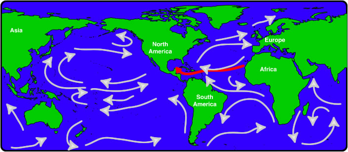
Let’s draw a route from Africa to the Americas on the map.
[Students draw on their maps.]
All of these ocean-going explorers, from Ireland, Norway, China, and Africa, had one thing in common: they were met by people who already lived here in the Americas. We do not know how long people have lived in the land we call the Americas. But we do know that 12,000 years ago there was a widespread Native American culture.
Today, their descendants are among the many people who are Americans. During the past several thousand years there must have been many “discoverers.” They crossed the ocean or the land to explore new valleys and mountain ranges. They were the first people to settle in the forests and grasslands of the continents that we now call the Americas. These are the people we call Native Americans.
[Fade off the five map images.]