The Kamal
Many ancient cultures devised ingenious ways to navigate and find their way, in their desire to explore and trade with other peoples in the world. In the process of trading, these navigation techniques were also traded.
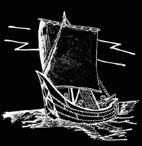
VISUAL 8 (still): African Ship
Archaeological evidence suggests that around 2,800 years ago, African sea-roving traders may have sailed to present-day southeastern Mexico, the home of the Olmec people. That’s over 2,000 years before Columbus made his famous voyages. Olmec culture is probably the oldest of the great Central and South American civilizations.
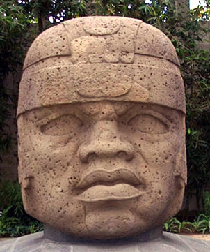
VISUAL 9 (still): Olmec Stone Head
Olmec artists carved massive stone sculptures that appear to show a person with African features, wearing a distinctly African style headdress. The sculptures are found at a number of sacred sites in southeast Mexico where the giant heads were erected. When European explorers arrived much later, they were told of dark-skinned people living to the south. Metal alloys that the natives used for spear points were previously found in Africa. The exchange must have been both ways, since plants such as tobacco and corn were found in Africa, but originated in America.
DIGITAL EFFECT: Go to Africa
Fade off all images, then crossfade the scene to the coordinates of Algiers, North Africa, (36° N, 2° E) today at noon. Display coordinates.
The kamal is an ancient tool used by Arab traders. It is likely that northern African sailors also used the kamal to tell how far north or south they had traveled. Let’s see how sailors may have used the kamal. Pretend we are near the big port city of Algiers in northern Africa.Play ocean sounds. Hand out kamals, and show how they are used to measure the altitude of Polaris.
Optional
Go on another journey back to Algiers. Move latitude back towards the north, and have the students use their kamals to tell you when you have returned to the right mark for the home port of Algiers.
Hold the wood block of your kamal so that its bottom edge lines up with the horizon and its top edge lines up with Polaris. The block has to be a certain distance from your eye to have the top and bottom edges on Polaris and the horizon. Holding the block in that position, extend the rope to your chin. The rope’s knot that is closest to your chin is the knot for your home port of Algiers. Remember which knot that is by counting the knots from one end of the rope. Each other knot is the length of rope that would be our Polaris marker for other port cities where we might go.
If the Kamal block is moved closer to your eye, would that make the Polaris mark higher or lower in the sky? [Higher.]
Would that be for a port farther north or farther south than Algiers? [Farther north.]
Let’s go on a journey from Africa west to the Americas. Make sure you remember which knot is for Algiers.
DIGITAL EFFECT: Go to SE Mexico
Travel to the coordinates of Cancun, Mexico (20°N) over 30 seconds. During the “travel time,” fade the atmosphere on (over 2 seconds) and off (over 2 seconds) five times to simulate the passage of time over many days—even though no time is actually changing. Use a 4 second delay between the fade down and the following fade up of the atmosphere so the stars are visible for more of the “trip.” Clear position information for this segment.
We have sailed over 4000 miles west from Africa to Central America.
Now use your kamal to see if we are farther north or south from where we were in Africa. [Farther south.]
We are in southeastern Mexico, where African traders may have landed 2,000 years before Columbus. We do not really know how they navigated, but they may have used an instrument like the kamal to find how far north or south they had traveled.
DIGITAL EFFECT: Position On
Turn on the position information. Use to confirm we have indeed traveled further south.

Fade off ocean sounds.

DIGITAL EFFECT: Clear the position information.