Views of Mars from Orbit
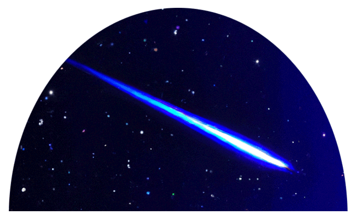
DIGITAL EFFECT: Go To Mars
Lift off Earth, and move away to view Earth from space. Introduce a slow orbital motion.
DIGITAL EFFECT: Fly to Mars
Move to Mars in two stages. In the first stage, turn towards Mars, and approach Mars so it appears as an appreciable dot. In the second stage move close to Mars (7.5 megameters). Slowly orbit Mars. Give the appearance of “orbiting” around Mars by having Mars move along the dome springline indefinitely.
In the space age, there are so many exciting new questions about the Red Planet! But whatever happened to the famous canals, the long straight lines that Lowell imagined must be giant irrigation channels carrying water to Martian farms? Only a few features photographed by spacecraft, such as the “grand canyon of Mars,” Valles Marineris, correspond to any of the narrow lines on Lowell’s canal maps.
VISUAL 7 (still): Space Telescope Views of Mars
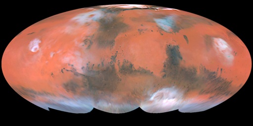
This global view of Mars was taken by the Hubble Space Telescope, and shows almost the entire surface of the Red Planet. The Hubble Space Telescope images are far sharper than any ever taken from Earth, and they show details smaller than any Earth-based observer sees.
Do you see a network of narrow lines that looks like the canal map Lowell drew? [No.]
You have seen how hard it is to see details on Mars telescopically from Earth’s surface. Very few other astronomers could see all the lines Lowell drew. As long as we had to look up through Earth’s blurry atmosphere, we could never see Mars clearly enough to be certain about the canals. Now we can see Mars clearly, any time we choose, from Earth orbit. We cannot see Lowell’s canal network.
Lowell did a lot of very valuable work in planetary photography, studies of nebulae, and determination of the rotation rates of the planets. He popularized many imaginative ideas about the possible forms of life on other worlds. But his observations of Martian “canals” were not correct. Apparently, the human mind “helps” the eye by filling in details that the eye only partially sees.
VISUAL 8 (still): Mariner 9 Spacecraft
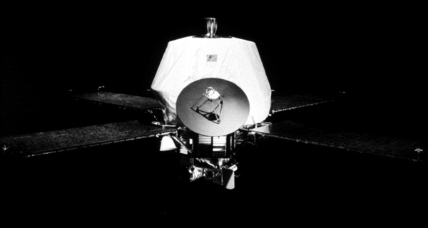
Fade on a still image of Mariner 9, attached to Mars, 180 degrees away from Mars. Use digital script to move the spacecraft slowly across the sky.
The Mariner and Viking missions of the 1970s sent us our first high-quality views of Mars from space. In 1976, the Viking Landers gave us our first really close-up look at the Martian surface. In the space age, once more we see the Red Planet in a new way. When Mariner 9 arrived in 1971, a planet-wide dust storm covered Mars for months, obscuring surface features. Earth-based telescopes have observed such dust storms on Mars.
VISUAL 9 (optional movie): Martian Dust Storm

The dust finally settled, revealing giant volcanoes larger than any mountains on Earth, a vast canyon system over 2500 miles long and five times deeper than our Grand Canyon.
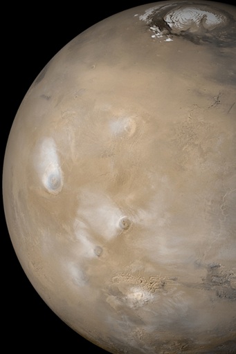
VISUAL 10 (still): Mars Global View

Point out Valles Marineris.
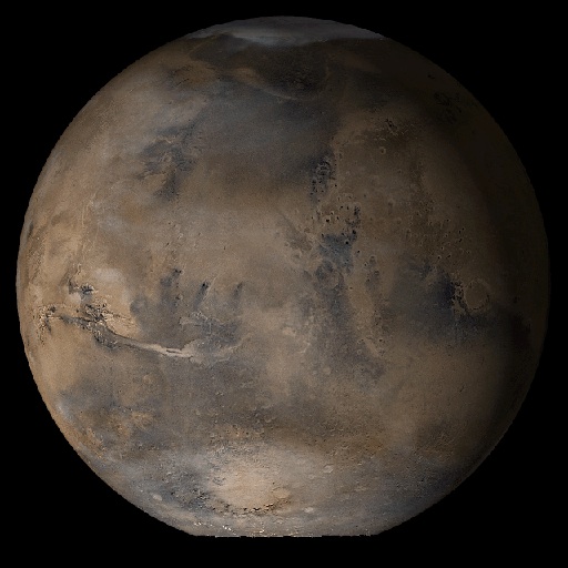
This is a composite of images from Mars Global Surveyor, Mars Orbiter Camera. The huge feature, Valles Marineris, named after the Mariner spacecraft, turns out to be one of the narrow lines drawn on Lowell’s canal maps.
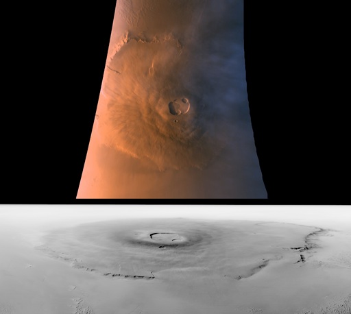
VISUAL 11 (still): Valles Marineris Close-up —data from Mars Global Surveyor
Scale up a still image of the Valles Marineris from Mars, and locate it off to the side of Mars and the Mariner 9 image.

This close-up mosaic of the Valles Marineris was fitted to a computerized topographic model. The entire Valles Marineris canyon system stretches 4,000 km, is 200 km wide, and can be up to 7 km deep.
DIGITAL EFFECT: End Mariner/Valles
Scale the Valles Marineris back down to Mars, and fade off the Mariner 9 image.
VISUAL 12 (still): Mars Volcanoes— image from Mars Global Surveyor
Scale up a still image of Mars to the side of Mars, with Olympus Mons highlighted, and locate it to the side.
Point out Olympus Mons.
Here’s the largest volcano, Olympus Mons. The Mariner and Viking Orbiter images also show sand dunes, craters from meteor impacts, and striking evidence of water erosion on the Martian surface. Water ice clouds are present over Olympus Mons (right center) and other large volcanoes in the region. The summertime north polar residual water ice cap can be seen at the top of this picture.
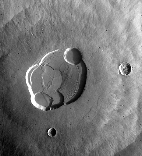
VISUAL 13 (still): Olympus Mons Caldera — Mars Global Surveyor
[Scale up a closeup of the Olympus Mons caldera from the Olympus Mons closeup, and locate it to the side.]
Very few meteor craters show up here at the summit of Olympus Mons, so the volcano may have erupted in recent geologic times. Underground, perhaps it is warm enough for liquid water to exist.
VISUAL 14 (still): Olympus Mons — Mars Global Surveyor
[Scale up a closeup of Olympus Mons from the Global Olympus Mons image and locate it to the side.]
The base of the Olympus Mons volcano would almost cover the entire state of Arizona! Here we see it from above and from an oblique view.
[Fade off the three Olympus Mons images in reverse order.]
VISUAL 15 (still): Gully Channels in a crater—image from the Mars Reconnaissance Orbiter
[Scale up a still image of gully channels from Mars, and locate it 180 degrees from Mars.]
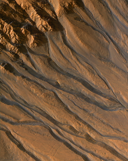
Here is a striking picture. How do you interpret this photo? These look like water-cut river channels with streamlined islands — but there is no liquid water on the Martian surface now. This raises a very important question: Where did the water come from and where has it all gone? Was the climate on Mars once much more like the Earth, with lakes and oceans in which life could have arisen?
[Fade off the River Channels image.]
Note: There are a few different effects that may be used while in orbit around Mars.

DIGITAL EFFECT: Location Tags
Fade on location tags for Mars, indicating the positions of Olympus Mons, the Valles Marineris, and the Spirit and Opportunity rovers. Orbit around Mars to find the targets as time and interest allow.

DIGITAL EFFECT: Mars Dust Storm
Superimpose a short movie of a global dust storm over the model of Mars. Show how some features on Mars are sometimes hidden when dust storms envelop the entire planet.

Presenters may wish to fly manually around Mars to show the most relevant views for the audience.
VISUAL 9 (optional movie): Dust storms on Mars
We have now been able to record—ever since the Mariner missions—gigantic dust storms that have encircled the Red Planet. These dust storms make it difficult or even impossible to observe any surface features. A global dust storm like this one actually endangered the Mars Exploration Rover mission for a time. Since the dust was so thick and prevailed for so long, the mission team was worried the solar panels would not be able to provide enough power to rovers to operate.